Streets of Mt Albert

Allendale Rd in Mt Albert


The street names of Mt Albert hold some interesting stories – some obvious, some not so obvious and others unknown. The detail here was drawn from Auckland Libraries website, the records of Mt Albert Historical Society,  and the website timespanner.blogspot.co.nz

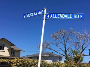
Alamein Tce: Probably named after the World War Two battle; Alberton Ave:  This was originally the avenue leading to the Taylor household at Alberton. Part was known as Rob Roy Rd (or street), becoming Alberton Rd from the 1920s-30s; Alexis Ave: Known as Alexandra Ave until 1938 and, in 1874, referred to as Chapel St at the Methodist church end; Allendale Rd: Named after the farmhouse built by Edward Allen at 1 Mt Albert Rd; Amandale Ave: No recorded history on the name; Ambrose St: No recorded history on the name; Asquith Ave: Named after the 19th century British Prime Minister. It was previously known as Whau Rd, Old North Rd and Avondale Rd; Atawhai Lane: A New private road at 702 New North Rd, endorsed by Auckland City Council in 2009. It allows right of way access to Housing NZ dwellings. Atawhai is Maori for kind, generous.

Baldwin Ave: Probably named after former British Prime Minister Stanley Baldwin; Barrymore Rd: No recorded history on the name; Benfield Ave: Part was previously Old Counsel Road finishing at number 13. It was changed to West Street in 1912 and an extension connecting it with Williams (now Wilcott) was named Frederick Street. Frederick Carrington was the surveyor for the area. Following a murder/suicide in 1927, Frederick Street and West Street were renamed as Benfield Avenue in 1928; Bennett St: Previously (until 1938) Albert St. Probably named after a former Mt Albert mayor, A. F. Bennett (1921-23); Braemar Tce: No recorded history on the name; Brewster Ave: Previously Bruce Ave (until 1938). History not recorded; Burch St: No recorded history on the name; Burnside: No recorded history on the name.

Carrington Rd: Part was Gladstone Rd (until 1938). Previously it was Onehunga-Mt Albert Rd (part). Probably named after British politician Lord Carrington, but Frederick Carrington was the surveyor for the area; Cassino Tce: Probably known after the Italian town, the centre of a fierce battle involving New Zealand servicemen in World War 2; Caughey Pl: Probably named after the noted Auckland family; Challinor Cres: No recorded history on the name, though Challinor St, Kohimaramara, was named after Dr Challinor Purchas; Chatham Ave: No recorded history on the name; Counsel Tce: Part became West Street (1912), now Benfield Road. Counsel Terrace was named by the original subdivider Judge Rogan. An extension to West Street connected it with Williams (now Wilcott) was named Frederick Street. Frederick Carrington was the surveyor for the area. Following a murder/suicide in 1927, Frederick Street and West Street were renamed as Benfield Avenue in 1928.

Delphine Cl: No recorded history on the name; Doreen Ave: No recorded history on the name; Douglas Ave: Likely named after Ronald Douglas McLean, son of Murdoch McLean who was mayor of Mt Albert 1914-1917; Duart Ave: Named after the ancestral home of the McLean clan in Scotland. Murdoch McLean was Mayor of Mt Albert5 from 1914-17; Dunkirk Tce: Probably named after the World War 2 evacuation.

Ennismore Rd: No recorded history on the name; Exeter Rd:  Presumably named after the town in Devon, Britain.

Fairleigh Ave: No recorded history on the name; Ferner Ave: Previously named Belmont Ave. Changed in 1939 – presumably after former Mayor of Mt Albert (1933-36), Raymond Ferner; Fifth Ave: No recorded history on the name, but presumably a simple numerical progression; Fontenoy St: Previously Fourth Ave. Named after the New Zealand Freighter Company vessel; Fowler Ave: No recorded history on the name; Francis Ryan Close: Named after the Mayor of Mt Albert (1968-89), Frank Ryan.

Glentui Rd: No recorded history on the name; Grande Ave: No recorded history on the name, but presumably linked to its elevated position and views; Grant St: No recorded history on the name; Guardwell Tce: Previously Gardner Tce. Name changed in 1938 after confusion with Gardiner Rd, New Lynn. No recorded history on the name.

Hallam St: No recorded history on the name; Harbutt Ave: Named by Sydney Harbutt, a prominent Auckland businessman and well known in musical circles, who developed the area for subdivision from 1932. His father, Thomas Jefcoate Harbutt, brought the corn broom industry to New Zealand and tried unsuccessfully to grow corn on his land in the area; Hargest Tce: Named after Brigadier James Hargest, who was killed in the Second World War; Harlston Rd: No recorded history on the name; Hendon Ave: No recorded history on the name; Highland Rd: No recorded history on the name.

Jennings St: Part of the Harbutt estate, dating from 1932. No recorded history on the name; Jerram St: No recorded history on the name; Jersey Ave: In 1937 it was described as 100 yards long, with 16 residences and named 10 years before (1927). Part of the Harbutt estate, dating from 1932. No recorded history on the name; Jesmond Tce: No recorded history on the name.

Kerr Taylor Ave: Named in 1959 after the pioneering Taylor family, who lived in nearby Alberton; Kitenui Ave: From Maori for “seeing many things” (presumably for its mountain views to the south and city views to the north). Known as Mountain Rd until 1938. Knight Ave: Named after the landowner and subdivider. In 1937 it was described as 5 chains long, with 3 residences.

La Veta Ave: Named by the Pickens family after La Veta in Colorado where Thomas and his first wife Anne Pickens lived; Laurel St: Previously Farrer St. Named after the shrub. Part of the Woodward or Springleigh estate; Leone Tce: No recorded history on the name; Linwood Ave: Previously part Challinor Crescent. In 1937 it was described as having 29 residences and named 12 years before. But no recorded history on the name; Lloyd Ave: May have been named after Reverend John Fredrick Lloyd, Vicar of St.Pauls, Auckland, 1853-1865, and later Archdeacon of Waitemata (d.1875); Lorraine Ave: Perhaps name from the Second World War association; Lyon Ave: No recorded history on the name.

Malvern Rd: Previously Asquith Avenue (to 1982) and Old Whau Road. Possibly named for Reverend Malvern who ministered in Auckland about 1850. In 1937 Malven Road was described as 300 yards long, with 51 residences and named between 25 and 35 years before (1902 – 1912); Margaret Ave: In 1937 it was described as 1/4 mile long, with 21 residences. But no recorded history on the name; Mark Rd: Likely named

after Mark Woodward, an early settler who died in 1895. Part of the Woodward or Springleigh estate; Martin Ave: Named after family associated with area. William Hurst Martin was a member of the former Mount Albert Road Board and Mount Albert school committee. In 1937 it was described as 100 yards long, with 10 residences; Maybeck Rd: Named after the May and Beck families; McGehan Cl: Possibly named after a resident of the area, who was also a member of the Mount Albert Borough Council; McLean St: Previously Murdoch Road (to 1938). Probably named after a Mayor of Mount Albert, Murdoch McLean (1914-1917); Monaghan Ave: Named after a widow Mrs Ann Monaghan (former Caldwell), an early property owner, who sold some of the family’s 20 acre estate for the Pt Chevalier School in 1887. She died in 1898; Moreland Rd: No recorded history on the name; Morning Star Pl: The residential development at 51 A St Lukes Road and 15 Lyon Avenue resulted in the creation of a private road or street from St Lukes Road. This enables access to over 160 apartments, known as St Lukes Garden Apartments. This road was endorsed 14 November 2003. The developers were Morning Star Enterprises; Mt Albert Rd: No explanation necessary!; Mount Royal Ave: No recorded history on the name; Mountfield Tce: Known as Mountain Tce until 1938 and no recorded history on the “new” name.

Newcastle Tce: Part of the Harbutt estate, dating from 1932. No recorded history on the name; Norgrove Ave: No recorded history on the name; Norrie Ave: Probably named after Lord Norrie, Governor General 1952-57.

Oakfield Ave: Previously Oak St, and changed to Oakfield in 1938; Olympus St: No recorded history on the name; Owairaka Ave: Previously Vincent Road. Named after Wairaka, daughter of Ngati-Awa Chief Toroa.

Parkdale Rd: Previously Second St. Became Parkland Rd around 1935; Parkhill Rd: Named in 1926 and, 11 years later, was described as 80 yards long, with 10 residences; Phyllis St: Previously Bank St. Part of the Woodward or Springleigh estate, but no recorded history on the name; Pickens Cres: Named after the Pickens family, who also named La Veta Avenue. Completed around 1955; Preston Ave: Named after a family associated with area. Described in 1937 as having 18 residences and named 15 years before; Prospero Tce: Until 1938, named Prospect Tce, but no recorded history on Prospero (a character in Shakespeare’s The Tempest).

Raetihi Cres: Previously Herbert Road. Part of the Woodward or Springleigh estate; Range View Rd: No recorded history on the name; Ranleigh Rd: No recorded history on the name; Rawalpindi Rd: Presumably named after the Pakistan city, but unclear why; Renton Rd: Previously Park Road, part of the Woodward or Springleigh estate; Rhodes Ave: Probably named after Leonard Rhodes, Mayor of Mount Albert Borough (1923-31). Part of the Woodward or Springleigh estate; Richardson Rd: Originally known as Robertson’s Rd (until 1903 at least) and unclear why it became Richardson; Rocky Nook Ave: Previously part Malvern Road, Seymour Road; Rossgrove Tce: Until 1938 known as Roslyn Tce; Ruarangi Rd: Previously (to 1932) Hillside Terrace. Probably named after a cave on the south side of Mount Albert – Te Aro Tomo O Ruarangi.

Sadgrove Tce: Named after William Sadgrove, a local landowner; Sainsbury Rd: Initially named (1925) Salisbury Rd and, in 1937, was described as 19 chains long, with 12 residences. Became Sainsbury Rd in 1938; Seaview Tce: in 1937 it was described as 1/4 mile long, with one business premises and 46 residences. Was previously Clay Street, probably named after a Mayor of Mt Albert, T. Clay (1917-1921); Segar Ave: Until 1939 known as Second Avenue. Possibly named after Segar House, which was a local home for intellectually handicapped people; Selcourt Rd: Known as Selwyn Rd  until 1938 when it was described as 10 chains long, with 4 residences. No recorded history on the name; Selkirk Rd: Possibly named after Alexander Selkirk, the Scottish castaway thought to have inspired the book Robinson Crusoe; Seychelles St: Previously (until 1938) part of Seymour Rd and presumably named, for some reason, after the island nation; Soljak Pl: Known on old deeds as Albert Road, but name weas never used in a public sense. Renamed to honour Mt Albert borough councillor Laurie Soljack, who died in 2000; Springleigh Ave: Named from the Springleigh housing estate, and was originally a farm that Mark Woodward bought from Sir John Logan Campbell; St Lukes Rd: Presumably named after the building of St Luke’s Church in 1871; Stewart Rd: Named after a pioneer landowner in the area. In 1937 Stewart’s Road was described as 1/2 mile long, with 34 residences; Stilwell Rd: Previously (until 1938) known as Belmont Rd. Probably named after former Mayor W. F. Stilwell (mayor from 1931-33); Summit Dr: Previously named Domain Rd, and changed in 1938;

Tasman Ave: Previously (until 1939) known as Third Avenue. Named after explorer Abel Tasman; Taylors Rd: This road follows the route of the very first driveway leading to the Allan Kerr Taylor’s home, Alberton, and was named before 1890. In 1937 Taylor’s Road was described as 10 chains long, with 1 business premises and 5 residences; Thomas Ave: Described in 1937 as 300 yards long, with 13 residences. But no recorded history on the name Toroa Tce: No recorded history on name.

 Verona Ave: Named after the warship; Vinter Tce: In 1937 described as 7 chains long, with 15 residences. No recorded history on name; Violet St: Previously named Victoria Ave. Changed to honour Adeline Violet Taylor of the Kerr-Taylor family.

Wagener Pl: No recorded history on name; Wairere Ave: Previously Selwyn Rd and in 1937 described as 200 yards long with 1 business premises and 29 residences. No recorded history on name change, but presumably connected with the stream that once ran on the surface (Wairere is Maori for stream of water or waterfall); Wesley Ave: Possibly named after John Wesley, founder of the Methodist Church. In 1937 it was described as 6 chains long, with 6 residences; Weston Ave: Described in 1937 as ¼ mile long, with 38 residences. No recorded history on name; Willcott St: Previously (until 1938) William St. No recorded history on name; Willis St: Named after an early farming family; Wolseley St: No recorded history on name; Woodward Rd: Likely named after a local settler, Mark Woodward, who died in 1895. The Woodwards arrived in New Zealand in 1866, and the street was formed before 1872.